The Yandex team presented the "Isochrone" API tool, designed to help businesses determine delivery zones depending on travel time.
The product is aimed at courier services and companies in the fields of food delivery, retail and e-commerce. Yandex explained:
For example, restaurants will be able to show customers the cost and estimated waiting time for an order, and organizations with several branches will be able to determine from which branch it is faster to get to the customer. In the field of development, with the help of "Isochrone" API, you can assess the proximity of real estate to urban infrastructure - metro stations, schools or supermarkets.
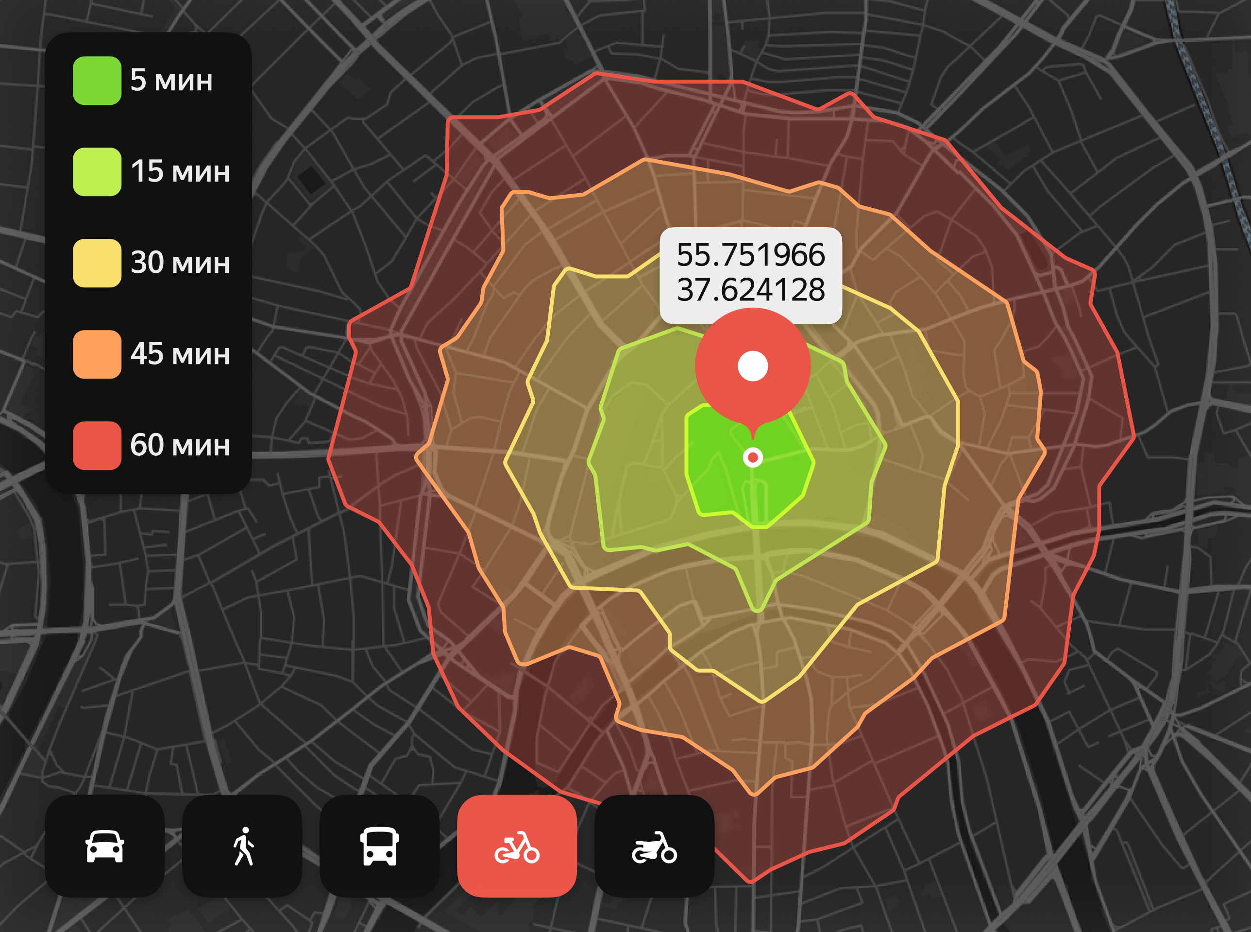
The "Isochrone" API takes into account different modes of transportation: by car, bicycle, public transport, scooter or on foot. To build the boundaries of the accessible zone, it is enough to specify the starting point and
select a suitable time interval - 5, 10, 15 minutes, and so on. A zone within an hour is available for cars, and up to 45 minutes for other modes of transportation. The service takes into account traffic jams, weather forecasts and adapts delivery zones to changes in the situation on the roads.
The "Isochrone" API is already used in "Yandex Eats". It allows you to accurately determine the delivery zones for partner restaurants, so that users see in the application only those establishments from where they can receive an order.